





UK Offline Road Map - OS Based

UK Offline Road Map - OS Based介绍
OS (Ordnance Survey) offline map atlas of Great Britain.
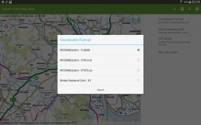
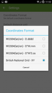
British National Grid coordinates as an option to standard latitude, longitude.
UK Atlas covers England, Wales, Scotland, Orkney, Shetland, Western Isles, Isles of Scilly and Isle of Man. Northern Ireland and the Channel Islands are not covered by this application.
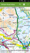
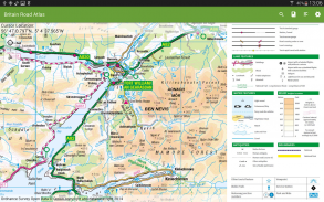
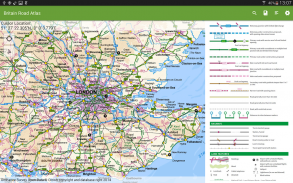
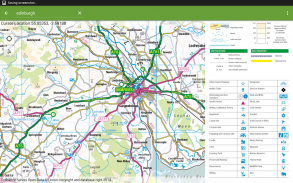
Application provides a regional view of the landscape which is similar in content and appearance to a typical road-atlas.
On the map you can browse:
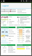
- Cities, towns, villages, centres of population,
- Motorways and junction numbers, A and B roads,
- Railways,
- Rivers,
- Some woodland features and wind farms location.
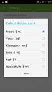
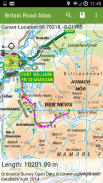
The app is ideal for route planning and geographic context. You can show/follow your current location and calculate distance between points using 'tap' action.
With this app you do not need the paper atlas any more. You will get same level of details - popular OS 1:250K scale and you will be able to check alternative routes just in few seconds.
The application provides support for geographic and British National Grids coordinates - set your default format in settings.
You always know where you are and how to get to your destination.
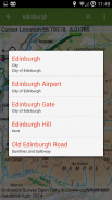
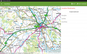
UK Map Atlas contains 1:50 000 Scale Gazetteer which is a GB reference tool and location finder containing 250,000 distinctive place and feature names.
Contains Ordnance Survey Open Data © Crown copyright and database right 2015.
</div> <div jsname="WJz9Hc" style="display:none">OS(军械调查)离线地图大不列颠的地图册。
英国国家电网坐标作为一个选项,以标准的纬度,经度。
英国阿特拉斯包括英格兰,威尔士,苏格兰,奥克尼,设得兰群岛,西部群岛,锡利群岛和马恩岛。北爱尔兰和海峡群岛不属于该应用程序。
应用程序提供了在内容和外观为典型的道路地图集类似的景观区域视图。
在地图上可以浏览:
- 城市,城镇,村庄,人口中心,
- 高速公路和连接数,A和B的道路,
- 铁路,
- 里弗斯,
- 一些林地的特点和风力发电场的位置。
该应用程序是理想的路线规划和地理环境。您可以显示/按照你的当前位置,并计算出使用'水龙头'动作点之间的距离。
有了这个程序,你不需要纸寰了。你会得到的细节同一水平 - 流行的OS 1:250K的规模,你将能够检查替代路线只是在几秒钟内。
该应用程序提供了地理和英国国家电网的支持坐标 - 设置默认的格式设置。
你总是知道你在哪里,以及如何到达目的地。
英国地图地图集包含1:5万规模地名是一个GB的参考工具,包含25万鲜明的地方和功能名称的位置取景器。
包括地形测量开放数据©皇家版权和数据库权2015。</div> <div class="show-more-end">


